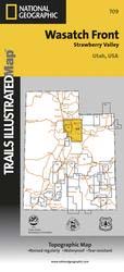
This Trails Illustrated topographic map is the most comprehensive
and complete recreational map for Utah's Wasatch Front/Strawberry
Valley area. The map shows all trails, campsites, and recreational
features, plus valuable wilderness and Leave No Trace guidelines.
This map includes many miles of ATV Trails
in the Daniels Summit area, just east of Salt Lake City.
Coverage includes Uinta National Forest; Southern Wasatch National
Forest; Twin Peaks, Lone Peak and Mt. Timpanogos Wildernesses;
Spanish Fork, Soldier Summit, Cottonwood Heights, Kamas, Heber
City and American Fork; Cottonwood, Mill Creek and Spanish Fork
Canyons, Mirror Lake - West, Rockport Lake, Deer Creek, Currant
Creek and Strawberry Reservoir.
All data is updated to reflect road closings, new trails, and
campground relocation. Printed on waterproof, tear-resistant
material with a plastic coating that offers supreme durability for
your next outdoor adventure.
Measures 4" x 9" folded and 28" x 32" fully opened. Scale =
1:90,000.