|
ATV Trails Books Maps & Guides
|
||||
|
These books are the books that
I use as guides when I am in Colorado and Utah. I highly recommend
these books to anyone thinking of going to these areas. Though these
books are for Jeeps most of the trails can be ridden by ATVs and
Motorcycles 678-378-7937 All
Items are shipped next business day via USPS Priority Mail
|
||||
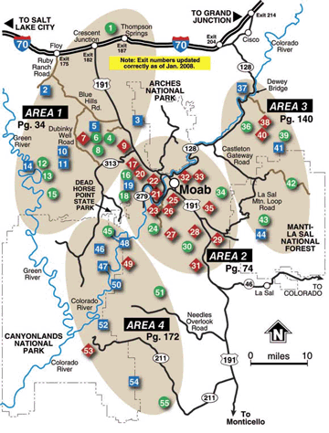
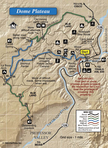
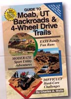
Guide to Moab, UT
Backroads & 4-Wheel Drive Trails
 2nd
Edition 2nd
EditionNational Geographic's Trails Illustrated Map 500 + 501 55 Trails • 60 maps • over 335 color photos • 224 pages
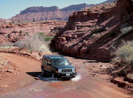
Covers 55 exciting trails around incredible Moab, Utah, including trips inside Canyonlands and Arches National Parks. Also features most trails from the annual Easter Jeep Safari, including favorites like Golden Spike, Pritchett Canyon, Hell's Revenge, Poison Spider and Moab Rim. Twenty-eight trails are suitable for most stock sport utility vehicles. Includes GPS Waypoints. This is a great guide for both ATVs and Jeeps. This book has been completely redone and updated by author Charles A. Wells. Expanded to 55 trails with 10 all new. Stunning full-color shaded relief maps show every contour of Moab’s rugged backcountry, including trails inside Canyonlands and Arches National Parks. Over 335 high-quality color photos. Thirty-five easy and moderate routes suitable for most high-clearance sport utility vehicles and pickup trucks. More Easter Jeep Safari trails including Strike Ravine and Dome Plateau. New format for GPS puts waypoints next to every map. |
||||
|
|
||||
|
Complete Trail Listing
|
||||
|
Detailed Map
|
||||
|
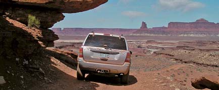
Sample Photos
Onion Creek, Trail #36, Easy |
||||
 White Rim, Trail #46, Moderate |
||||
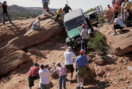 Flat Iron Mesa, Trail #31, Difficult |
||||
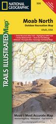 500 Moab North This Trails Illustrated topographic map is the most comprehensive and complete recreational map for the areas south of Moab, Utah. The map shows all trails, campsites, and recreational features, plus ratings and mileage for mountain biking trails and junction-to-junction road and trail mileage. Coverage area includes Green River, Fisher Towers and Arches National Park;
highlighted Jeep Safari Trails and Mountain Bike Trails from Moab to Interstate
70; enhanced coverage of Dubinsky Wash to the Green River. Includes detailed
1:35,000 scale insets of Moab, Slickrock Bike Trail, Sand Flats Recreation Area,
and Monitor and Merrimac Buttes/Bartlett Wash Area. |
||||
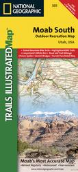 501
Moab South 501
Moab SouthCoverage area includes Moab, Dead Horse Point State Park, Behind the Rocks WSA, Hurrah Pass and Canyonland's White Rim; highlighted Jeep Safari Trails from Moab to Canyon Rims Recreation Area; and detailed 1:35,000 scale insets of Moab, Moab Rim, Poison Spider Mesa, Gold Bar Rim, and Gemini Bridges Area. All data is updated to reflect road closings, new trails, and campground relocation. Printed on waterproof, tear-resistant material with a plastic coating that offers supreme durability for your next outdoor adventure. Scale = 1:70,000 |
||||

|