|
ATV Trails Books Maps & Guides
|
||||||
|
770-463-2346 All
Items are shipped next business day via USPS Priority Mail
|
||||||
|
Paiute ATV Trail Guide + Trails Illustrated Map 708 |
||||||
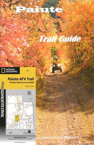 |
Page after page of
detailed information on the Paiute ATV Trails. Photos, Maps, GPS Data for
every intersection and point of interest on the trail, Tip and Tricks for
riding the Paiute ATV Trails. Divided into the major sections of this
mammoth trail system and includes information on how to access the trails
from each community surrounding the trail system and much more.
This guide also includes
National Geographic's Trails illustrated Paiute ATV Map 708
which is a very detailed map covering the
entire area including most side trails and the map also has enlarged
street views of were ATVs can be ridden in all towns along the trail.
This Trails Illustrated topographic map is the most comprehensive and
complete recreational map for Utah's Paiute ATV Trail. The map shows all
trails, campsites, and recreational features, plus valuable wilderness
and Leave No Trace guidelines.
Coverage includes Fishlake National Forest, BLM - Sevier River Resource Area; Millard, Sevier and Paiute counties; complete map of Paiute ATV Trail with adjoining loop trails and town access maps; Fillmore, Richfield, Koosharem, Marysvale, Geenwich and Circleville. Piute, Otter Creek, Rocky Ford, Koosharem and Three Creeks reservoirs. All data is updated to reflect road closings, new trails, and campground relocation. Printed on waterproof, tear-resistant material with a plastic coating that offers supreme durability for your next outdoor adventure. Measures 4" x 9" folded and 28" x 32" fully opened. Scale = 1:90,000.
|
$29.90 |
||||
|
Just need the Map! Get it here
Trails Illustrated topographic recreation and trail map.
|
||||||