|
ATV Trails Books Maps & Guides
|
|||||
|
These books are the books that
I use as guides when I am in Colorado and Utah. I highly recommend
these books to anyone thinking of going to these areas. Though these
books are for Jeeps most of the trails can be ridden by ATVs and
Motorcycles 770-463-2346 All
Items are shipped next business day via USPS Priority Mail
|
|||||
|
ATV Trails Guide Colorado Central Mountains |
|||||
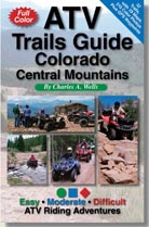
32 Trails • 33 color
maps • 215 color photos • 168 pages 5-1/2"x 8-1/2" ISBN 978-0-9664976-9-4 Only $19.95 
|
|||||
|
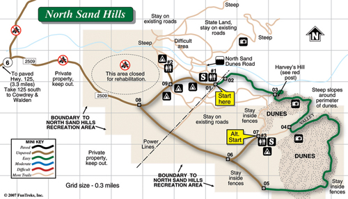
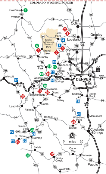
1. North Sand Hills (E) 2. Moody Hill (D) 3. Storm Mountain (D) 4. Pole Hill (M) 5. Stillwater Pass Road (E) 6. Idleglen OHV Area (D) 7. Pierson Park Road (M) 8. Johnny Park Road (D) 9. Plane Crash, Ironclads (D) 10. Caribou, Eldorado Mountain (M) 11. Rollins Pass West (E) 12. Rollins Pass East (E) 13. Jones Pass (E) 14. Bill Moore Lake, Empire Loop (D) 15. Yankee Hill, Kingston Peak (M) 16. Saxon Mountain, Lamartine (M) 17. Red & White Mountain (M) 18. Peru Creek (E) 19. Wise Mountain, Radical Hill (D) 20. Red Cone, Handcart Gulch (D) 21. Camp Hale Area (D) 22. Rampart Range OHV Area (M) 23. Rainbow Falls OHV Area (M) 24. North Divide 717 OHV Area (D) 25. Fourmile North (E) 26. Fourmile South (M) 27. Taylor Park (M) 28. Tincup/Hancock Loop (M) 29. Pomeroy Lakes (D) 30. Mt. Antero, Baldwin Lakes (M) 31. Otto Mears Toll Road (E) 32. Texas Creek (D) |
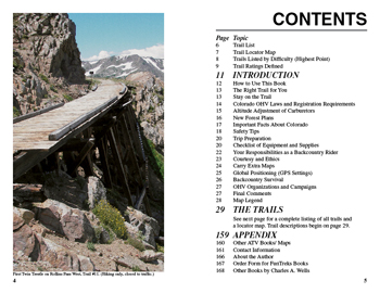
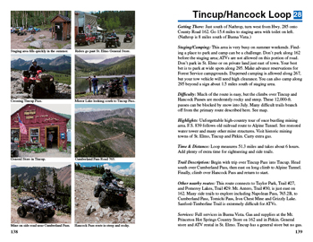
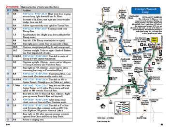
 Sample Map & Pictures
|
||||
|
Pages 4 & 5, Contents
Pages 138& 139, trail description page
Pages 140 & 141, 2-page trail description Sample Photos
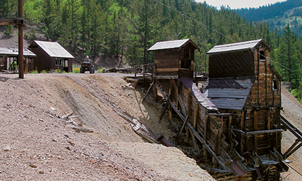
Rawley Mine on Otto Mears Toll Road, Trail #31, Easy
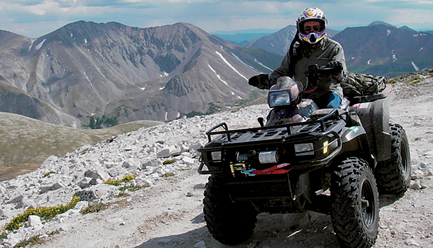
Near Summit of Mt. Antero, Trail #30, Moderate
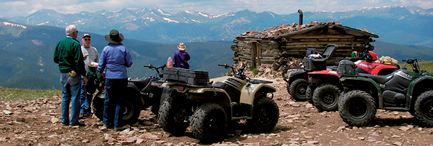
Cabin at Wise Mountain, Trail #19, Difficult
|
|||||